EU-funded project supports stress testing of Tajikistan’s disaster risk management system

Experts from the National Platform for Disaster Risk Reduction of Tajikistan, international and local organizations, and representatives of business and academia participated in a stress testing workshop of Tajikistan’s disaster risk management (DRM) system against the most impactful disaster scenarios in the country. The workshop was funded by the European Union (EU) and organized by the United Nations Office for Disaster Risk Reduction (UNDRR) within the joint project on disaster risk reduction in Central Asia.

Tajikistan’s Committee of Emergency Situations & Civil Defense and UNDRR concluded a comprehensive DRM system capacity assessment and planning exercise, which revealed major needs and challenges in the system and suggested a targeted plan of action to strengthen the disaster risk reduction (DRR) policy implementation in the country.

As the next step of the process, the EU-UNDRR project supported the National Platform to conduct a stress test analysis - a scenario-based multi-stakeholder assessment process to evaluate the state of national capabilities to reduce, absorb and transfer disaster risk and develop a targeted action plan to further support the strengthening of the DRM system. During the meeting, participants developed disaster scenarios for Tajikistan based on relevant sources, and prioritized required DRM system capacities against the disaster scenarios.

Over the past years, Tajikistan has made significant progress in increasing its capacity in DRM and in the implementation of the Sendai Framework for Disaster Risk Reduction 2015-2030. As part of the work towards reducing disaster risks, Tajikistan has developed and adopted the National Strategy for Disaster Risk Reduction in 2019, its implementation is guided by the National Platform for DRR. However, the increasing challenges posed by climate change and the rapid change of the global hazard trends may create strong stress for the DRM system of the country.

Cyber Insurance: Action Needed to Assess Potential Federal Response to Catastrophic Attacks

U.S. critical infrastructure (such as utilities, financial services, and pipelines) faces increasing cybersecurity risks. Understanding these risks and associated vulnerabilities, threats, and impacts is essential to protecting critical infrastructure.

Cybersecurity Vulnerabilities, Threats, and Impacts

Vulnerabilities. Critical infrastructure has become more vulnerable to cyberattacks for reasons that include greater use of interconnected electronic systems.

Threats. Threat actors—such as nation-states, criminal groups, and terrorists—have become increasingly capable of carrying out cyberattacks on critical infrastructure.

Impacts. Federal and industry data indicate that cyberattacks—including those affecting critical infrastructure—generally have increased in frequency and cost.

Source: Prior GAO reports and GAO analysis of agency and industry documentation.

The effects of cyber incidents can spill over from the initial target to economically linked firms—magnifying damage to the economy. For example, in May 2021 the Colonial Pipeline Company learned that it was the victim of a cyberattack that led to short-lived gasoline shortages.

Cyber insurance and the Terrorism Risk Insurance Program (TRIP)—the government backstop for losses from terrorism—are both limited in their ability to cover potentially catastrophic losses from systemic cyberattacks. Cyber insurance can offset costs from some of the most common cyber risks, such as data breaches and ransomware. However, private insurers have been taking steps to limit their potential losses from systemic cyber events. For example, insurers are excluding coverage for losses from cyber warfare and infrastructure outages. TRIP covers losses from cyberattacks if they are considered terrorism, among other requirements. However, cyberattacks may not meet the program's criteria to be certified as terrorism, even if they resulted in catastrophic losses. For example, attacks must be violent or coercive in nature to be certified.

The Department of the Treasury's Federal Insurance Office (FIO) and the Department of Homeland Security's Cybersecurity and Infrastructure Security Agency (CISA) both have taken steps to understand the financial implications of growing cybersecurity risks. However, they have not assessed the extent to which risks to critical infrastructure from catastrophic cyber incidents and potential financial exposures warrant a federal insurance response. CISA is the primary risk advisor on critical infrastructure and FIO the federal monitor of the insurance sector. Accordingly, they are well-positioned to jointly perform such an assessment. Doing so and reporting the results to Congress can inform deliberations on whether a federal insurance response is warranted.

If such a response were deemed necessary, GAO's framework for providing federal assistance to private market participants (GAO-10-719) could help inform its design. The framework notes the need to define the problem, mitigate moral hazard (that the existence of a federal backstop could result in entities taking greater risks), and protect taxpayer interests. Consistent with these elements, any federal insurance response should include clear criteria for coverage, specific cybersecurity requirements, and a dedicated funding mechanism with concessions from all market participants.

Cyber threats to critical infrastructure represent a significant economic challenge. Although cyber incident costs are paid in part by the private cyber insurance market, growing cyber threats have created uncertainty in this evolving market.

The Further Consolidated Appropriations Act, 2020, includes a provision for GAO to study cyber risks to U.S. critical infrastructure and available insurance for these risks. This report examines the extent to which (1) cyber risks for critical infrastructure exist; (2) private insurance covers catastrophic cyber losses and TRIP provides a backstop for such losses; and (3) cognizant federal agencies have assessed a potential federal response for cyberattacks.

GAO reviewed cyber insurance coverage literature and reports on cyber risk and the insurance market. GAO interviewed CISA and FIO officials and industry stakeholders (e.g., critical infrastructure owners, insurers, and brokers) that were selected based on factors such as expertise and market share.

Cyber insurance can help offset costs of some common cyber risks, like data breaches or ransomware. But cyber risks are growing, and cyberattacks targeting critical infrastructure—like utilities or financial services—could affect entire systems and result in catastrophic financial loss.

Insurers and the government's terrorism risk insurance may not be able to cover such losses. For example, the government's insurance may only cover cyberattacks if they can be considered "terrorism" under its defined criteria.

CISA and FIO should jointly assess the extent to which risks to critical infrastructure from catastrophic cyber incidents and potential financial exposures warrant a federal insurance response, and inform Congress of the results of their assessment. Both agencies agreed with the recommendations.

ESA-backed project supports oil and gas safety by keeping an eye on the ground

Oil and gas supplies are dependent on multiple factors, including the stability of the ground wherever oil or gas is being stored or transported. In March 2021, LiveEO started assessment and development of an end-to-end solution for monitoring ground deformation for the entire value chain of the industry, based on interferometric synthetic aperture radar (InSAR) satellite data combined with artificial intelligence (AI). The aim was to help the industry ensure safety across its assets by providing an early warning system that could inform maintenance or safety actions.
Providing actionable insights

Founded in 2017, LiveEO has a background in using Earth observation (EO) data to provide a range of services to operators of large-scale infrastructure, such as railways, electricity grids and pipelines. It combines data analysis with risk analysis to create actionable insights on aspects such as vegetation management, detection of construction activity and ground deformation monitoring — all of which present challenges for reasons that include climate change and environmental factors.

With this Kick-Start activity, co-funded by ESA, LiveEO’s team used its experience in servicing pipeline customers to explore the feasibility of a holistic, end-to-end solution for ground deformation monitoring. The investigation included risk models that quantify the risk to specific assets resulting from ground deformation and how the insights could be delivered to customers and integrated into their processes to create automatic triggers.

The LiveEO team analysed the opportunities through surveys of more than 50 companies and countries, including existing clients in the pipeline industry, as well as researching the broader landscape. Initial data came from Sentinel-1 synthetic aperture radar (SAR) imagery, which will be enriched by higher resolution StripMap and SpotLight SAR imagery from Capella Space or ICEYE satellites to investigate any anomalies that have been detected.

Sven Przywarra, the Co-CEO and co-founder of LiveEO said: “The Kick-Start activity enabled LiveEO to validate a business case in a unique setting, and also created an environment that allowed our business development team to take the right steps from a business idea to product development. The combination of guidance, support and clear goal setting from ESA was greatly appreciated, because it gave us the entrepreneurial freedom necessary for the exploration of new ideas paired with acquiring a depth of knowledge similar to a classic research project."
The increasing need for ground deformation insights

The requirement for such insights results from an increasing number of oil wells, pipelines, storage facilities and other oil and gas related infrastructure exceeding their original lifespans. This is leading to more complex maintenance for operators and increased risks that impact both the industry itself and the surrounding environment and communities. One of the major sources of risk is ground deformation due to industrial operations or natural seismic activity. Where infrastructure and assets span large areas, these risks can be very difficult to measure and dangerous trends can go undetected.

Traditional monitoring methods, such as land surveying or sensors and drones, can only give a partial picture. Satellites enable monitoring of deformation trends across entire countries with weekly update intervals — something that would be prohibitively expensive or even impossible via other means. InSAR data delivers deformation values at individual pixel levels, allowing the identification of trends over long periods of time; this can be supplemented with historical data.

The company is currently developing the AI side of the project, with the aim of completing development by the end of 2022. The plan is then to undertake a demonstration project and have a marketable subscription service ready by the end of the following year.

NCSC joins industry to offer unprecedented protection for public from scams

CITIZENS across the UK are set to benefit from a landmark partnership between government and industry which will see access to scam websites instantly blocked.

A new data sharing capability developed by the National Cyber Security Centre (NCSC) – a part of GCHQ – in collaboration with industry partners will present Internet Service Providers (ISPs) with real-time threat data that enables them to instantly block access to known fraudulent sites.

The new capability is being made available to all ISPs operating in the UK and will significantly bolster the nation’s ability to protect citizens from cyber criminals. In due course, even more defenders will be invited to join, including browser and manager service providers.

The NCSC has previously highlighted the problem of scam websites, including fake news pages where celebrities such as Ed Sheeran and Sir Richard Branson appear to be endorsing investment schemes that seek to trick people into parting with their money.

The satellite-enabled emergency response system that could make a life-saving difference

The COVID-19 pandemic has challenged ambulance services like never before. First RESPonse was created to help professionals respond to emergency calls more rapidly through enhanced technology. With support by ESA Space Solutions, the system developed in a Demonstration Project streamlined communication and information sharing throughout the chain of response and reduced call-to-hospital times for patients by up to 17%.

During the worst months of the COVID-19 pandemic, emergency call centres experienced extremely high rates of urgent medical calls. Coordination of the ambulance response was challenging and made more complex by the changing landscape of medical resources; hospitals were filling up, and temporary emergency facilities were opening.

The First RESPonse (First Rapid Emergency System against Pandemic) project launched in Italy in July 2020, with the aim to improve coordination of the entire process of a medical emergency request: from a patient’s distress call to the point of hospitalisation.

The project brought together two major players in European emergency service software and telecommunications: GINA Software and Beta 80. Forming a new consortium, the companies achieved complete integration of their products and – supported by ESA – incorporated space technology for enhanced geolocation accuracy and communication coverage.
Digital links for a faster chain

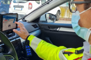
First RESPonse digitally connects each link in the emergency chain of response. It begins with an app on a citizen’s smartphone, through which they can call for help, see when help has been dispatched and when it is due to arrive. Ambulance dispatchers in the call centre have a constant digital connection to their crews via a workstation. They can keep them updated on the scene and patient’s condition, and the status of the nearest hospital facilities. First responders have a tablet through which they receive up-to-date information about the patient, automatic SatNav to their location and can video consult with a doctor from the field. They can also scan the patient’s ID card so that receiving hospitals know who is coming in, as well as seeing when they are expected.

The system was piloted by selected ambulance services in Italy and the Czech Republic and used in almost 9,000 incidents. In this pilot project, First RESPonse accelerated the pre-hospital chain by between 12 and 17%.

Arnaud Runge, Medical Engineer at ESA said: “In a medical emergency every minute counts. Cutting the time it takes an ambulance to reach a critically ill patient, and to get them to hospital, can make a life-saving difference. We’re proud to have enhanced First RESPonse with space technology.”
From pandemic to systemic

Following the successful completion of the pilot, First RESPonse is being promoted to emergency services more widely in Italy and the Czech Republic – where GINA and Beta 80 have most of their customers – and beyond.

Martin Ingr from GINA said: “The products and services that were created during the project are aimed to remain sustainable also after the pandemic is overcome. Our goal is that the problems solved through the First RESPonse project become part of the standard operation procedure. The system can be used again against this or other pandemics, during the response to disasters such as earthquakes, as well as improving daily operations of emergency services.”

[Source: ESA]

Closer stakeholder cooperation essential for ransomware investigations to succeed

The scale and impact of ransomware attacks have increased significantly over the past years, in part due to the COVID-19 pandemic. As such, the success of criminal investigations and prosecutions depends more than ever on close cross-border cooperation between public authorities, private companies and victims. Public-private cooperation is particularly valuable in such cases, as companies can preserve and provide the data and evidence investigators need to investigate crimes and identify criminals.

These are some of the main conclusions from the latest edition of the Cybercrime Judicial Monitor, featuring a special focus on ransomware investigations, published this month.

Cooperation between stakeholders in ransomware investigations is essential. This includes the reporting of ransomware attacks by victims, the preservation and possible analysis of digital evidence by private companies, and the investigation and prosecution by public authorities. The international dimension of investigations and the complexity of identifying criminals require early and close cross-border coordination between judicial and law enforcement authorities. Actions by each stakeholder group play a key role in the mitigation of damages, disruption of attacks and the identification and prosecution of perpetrators.

The report, based on practitioners’ input, highlights the challenges encountered in ransomware investigations. These include:

the loss of data and important e-evidence;
the criminal use of encryption and anonymisation techniques preventing the identification of suspects;
the complexity of investigations and the lack or delay of international coordination;
the absence of a harmonised data-retention legal framework; and
insufficient resources and expertise of law enforcement authorities.

Despite these obstacles, practitioners can learn from the many good practices showcased in the report. These include the swift notification of ransomware attacks to relevant authorities and the creation of technical reports by the victim or affected company. Continuous information exchange between the authorities and the victim/technical team has proved highly important. The provision of guidelines for public authorities on how to deal with ransomware attacks, as well as specialised training for police and judicial authorities, is also key.

The report underlines the successful use of joint investigation teams facilitated by Eurojust, which have led to the identification, arrest and prosecution of cybercriminals. The building of trust between public authorities and private companies by sharing information and regular communication is also essential. Although most countries do not have a specific legal framework for public-private cooperation, experience has shown that such frameworks have enabled ransomware investigations to succeed and that they are therefore much needed.

Testing the Resilience of the European Healthcare Sector

To ensure citizens’ trust in the medical services and infrastructure available to them, health services should function at all times. If health services and infrastructures in Europe were the object of a major cyber attack, how would we respond and coordinate at both national and EU level to mitigate the incidents and prevent an escalation?

This is the question Cyber Europe 2022 sought to answer using a fictitious scenario. Day one featured a disinformation campaign of manipulated laboratory results and a cyber attack targeting European hospital networks. On day two, the scenario escalated into an EU-wide cyber crisis with the imminent threat of personal medical data being released and another campaign designed to discredit a medical implantable device with a claim on vulnerability.

The Executive Director of the EU Agency for Cybersecurity, Juhan Lepassaar, said: “The complexity of our challenges is now proportionate to the complexity of our connected world. This is why I strongly believe we need to gather all the intelligence we have in the EU to share our expertise and knowledge. Strengthening our cybersecurity resilience is the only way forward if we want to protect our health services and infrastructures and ultimately the health of all EU citizens.”

The pan-European exercise organised by ENISA rallied a total of 29 countries from both the European Union and the European Free Trade Association (EFTA), as well as the EU agencies and institutions, including ENISA, the European Commission, the CERT of EU Institutions, bodies and agencies (CERT-EU), Europol and the European Medicine Agency (EMA). More than 800 cybersecurity experts were in action to monitor the availability and integrity of the systems over the two days of this latest edition of Cyber Europe.

Can we strengthen the cyber resilience of the EU healthcare?

The participants who engaged in the complex exercise were satisfied with the way the incidents were dealt with and the response to fictitious attacks.

Now, the analysis of the process and of the outcomes of the different aspects of the exercises need to be performed in order to get a realistic understanding of potential gaps or weaknesses which may require mitigation measures. Dealing with such attacks requires different levels of competences and processes which include efficient and coordinated information exchange, the sharing of knowledge around specific incidents and how to monitor a situation which is about to escalate in case of a generalised attack. The role of the EU level CSIRTs network and the draft standard operation processes (SOPs) of the CyCLONe group also need to be looked into.

The deeper analysis will be published in the after-action report. The findings will serve as a basis for future guidance and further enhancements to reinforce the resilience of the healthcare sector against cyber attacks in the EU.

Experts Assess Implementation of International Conventions on Nuclear Emergency Response


Countries need to work closely together in the event of a nuclear emergency, so sharing experience and improving emergency preparedness are key tasks stemming from the IAEA’s mandate. Those responsible for emergency preparedness at the national level – officially referred to as Competent Authorities – met in Vienna last week at the 11th Meeting of the Representatives of Competent Authorities identified under the Early Notification Convention and the Assistance Convention, and discussed ways to ensure that the necessary expertise, services and equipment are available promptly upon request by any government in the event of a nuclear or radiological emergency.

In his remarks, IAEA Director General Rafael Mariano Grossi referred to the role of the two conventions in relation to nuclear facilities in Ukraine. “Everything we have done to assist Ukraine in maintaining nuclear safety, security and an adequate level of safeguards; everything we have done to inform the wider world of the situation during this first military conflict fought in the direct proximity of a major nuclear power programme, we have done through the framework that many of you have built and improved in the years leading up to today…this framework is being tested like never before,” he said.

A strong and integrated international framework for notification and assistance in the event of a nuclear emergency is essential to protect people and the environment from the harmful effects of ionizing radiation, said the meeting’s Chair, Faizan Mansoor, Head of the Pakistan Nuclear Regulatory Authority. “This meeting is essential, since it gathers the world’s experts in nuclear emergency preparedness and response to determine if our arrangements remain effective when emergencies occur under increasingly complex conditions,” he said.

Competent Authorities are the entities designated by their governments to carry out specific duties with respect to issuing and receiving information relating to nuclear and radiological emergencies under these conventions. They meet every two years to evaluate and strengthen the implementation of the Early Notification Convention and the Assistance Convention. Both conventions were concluded in 1986, in the immediate aftermath of the accident at the Chornobyl Nuclear Power Plant, and establish the international framework for the exchange of information and the prompt provision of assistance in the event of a nuclear or radiological emergency, with the aim of minimising the consequences.

“Radiation does not recognize borders, and countries need to work together swiftly to prevent people from coming to harm in the wake of a transboundary radioactive release,” said Carlos Torres Vidal, Director of the IAEA’s Incident and Emergency Centre.
Preparing to Respond to a Rare Event

The IAEA has created a number of platforms and mechanisms, such as the Unified System for Information Exchange in Incidents and Emergencies (USIE), the International Radiation Monitoring Information System (IRMIS) and the Assessment and Prognosis Tools and the Response and Assistance Network to help countries work with each other, and with the IAEA and other international organizations, during a response. For example, USIE is a secure platform for information sharing that allows countries to fulfil their obligations under the Early Notification Convention; the same function is performed for the Assistance Convention by the Response and Assistance Network, or RANET, which allows countries to offer, and receive, assistance and expertise; and IRMIS collects and maps large quantities of environmental radiation monitoring data during nuclear or radiological emergencies.

The IAEA supports countries in setting up robust preparedness mechanisms, through the development of safety guides and publications, and the provision of trainings and other capacity-building initiatives.

Although most people associate nuclear emergencies with accidents at nuclear power plants, such as those at Chornobyl (1986) and Fukushima Daiichi (2011), such events are in fact very rare. At the same time, the Response and Assistance Network has been mobilized several times in the past decade to respond to countries dealing with the consequences of far more common radiological emergencies, such as workers becoming accidentally exposed to hazardous levels of radiation from contact with radiation sources used in industry or medicine.

“These past two years have demonstrated that emergencies come in diverse forms such as earthquakes, floods and fires, and that we need to pay more attention than ever before to our motto: Prepare. Respond. Improve,” said Lydie Evrard, Deputy Director General and Head of the Department of Nuclear Safety and Security.

New open-source software that decrypts social media messages to help manage risks and disasters

The European Commission’s new algorithm developed by the Joint Research Centre (JRC) can segment social media messages to identify, verify and help manage disaster events -such as floods, fires or earthquakes- in real-time.

Suppose you are an emergency responder and you see a social media post showing an unusable road in a place not covered by traditional news. Suppose you see a similar message from several accounts. Wouldn’t you wonder if they were referring to the same event or whether that area was worth a more detailed analysis with a satellite image?

It was with this in mind that scientists from the JRC helped deal with the 2021 Haiti Earthquake by using social media data analysis to complement the assessment of impacts in the immediate aftermath of the earthquake.

This experience was the first real case usage of a software platform that can scan millions of social media texts and images per day for situational awareness and impact assessment. This information is collected, filtered and geocoded automatically and in real-time using machine learning (artificial intelligence) models.
A software that helps responders with flood risk management

The first goal of this platform was to provide an additional geospatial layer in the European Flood Awareness System (EFASSearch for available translations of the preceding linkEN•••) and the Global Flood Awareness System (GloFAS). These two online systems offer flood forecasts based on model simulations which are crucial to the Copernicus Emergency Management Services Managed by JRC.

The monitoring ability of these early warning systems is mostly anchored in satellite images and numerical models.The integration of this new social media for disaster risk management (SMDRM) software will allow them to assess the likelihood and impacts of a flood event with even greater accuracy.
An open-source tool available to all researchers and technicians

The new layer for EFASSearch for available translations of the preceding linkEN••• and GloFAS is the first product developed using the SMDRM software. Nonetheless, since the software has been released as open-source -free and open to all technicians linked to crisis response who want to leverage it- the scientists expect it to have a wider use and they remain available for collaboration.

The SMDRM software can be adapted for different scales and label relevant images for floods, storms, earthquakes and fires, resulting in valuable information for reports or descriptions of the situation on the ground or in the vicinity.

Technicians or researchers working on map development can use the code to find more data to improve or confirm their findings and complement information extracted from traditional sensors or earth observation sources.
Software that connects citizens to disaster risk management

The SMDRM software data help confirm whether an event is happening and where exactly the most affected locations are.

It is a clear example of how social media and active citizenship can contribute to disaster risk management as it help crisis responders improve their situational awareness in the immediate aftermath of an event.

Submarine telecom cables enhance climate monitoring and tsunami forecasts

Over 1.3 million kilometres of submarine telecommunications cables now span the world’s oceans. As the network grows and old cables are replaced, the next generation of cables could form a real‑time ocean observation network able to provide accurate early warnings of tsunamis and a wealth of valuable data for climate science.

A standard SMART cable, meaning a telecom cable upgraded for “Scientific Monitoring And Reliable Telecommunications”, will include climate and hazard‑monitoring sensors designed to co‑exist with telecom components and to last for the same 25‑year lifespan as any commercial cable.

Climate scientists hope for the resulting ocean‑observation network to grow sustainably alongside commercial network deployments. The SMART cable will combine scientific sensing and telecoms into the same,shared submarine cable, never compromising reliable telecoms.

Two new standards now under development at the International Telecommunication Union (ITU) will support this aim, providing for both SMART cables and cables dedicated exclusively to scientific sensing. This standards effort builds on minimum requirements established by the Joint Task Force on SMART Cable Systems, formed in 2012 with the support
of ITU, the UNESCO‑Intergovernmental Oceanographic Commission (UNESCO‑IOC) and the World Meteorological Organization (WMO).

“We aim to reach a point where cable system suppliers are offering all their customers the option of standardized SMART capability,” says task force chair Bruce M. Howe, a University of Hawaii research professor.

At Station ALOHA 100 kilometres north of Oahu, Howe installed and now operates a cabled scientific observatory at a depth of 4728 metres, making it the world’s deepest of its kind.

The Joint Task Force has helped develop the technical and financial feasibility of SMART cables. It now works closely with United Nations organizations, governments, and businesses intent on deploying SMART cables at scale.
A Portuguese first

Two years ago, Alcatel Submarine Networks became the first cable provider to commit to SMART, while Portugal’s telecom regulator ANACOM pledged to build SMART into the new CAM [Continent‑Azores‑Madeira] ring cable connecting the mainland to islands a thousand kilometres out in the Atlantic Ocean.

“SMART cables have been on our agenda since 2018, when planning the replacement of the ageing existing cables,” says João Cadete de Matos, Chair of ANACOM.

The submarine cable division of NEC Japan has installed more than 6000 kilometres of submarine cables dedicated to scientific sensing, which are now operated by Japan’s National Research Institute for Earth Science and Disaster Resilience. The first submarine cables for tsunami forecasts were deployed 12 years ago, and the network was expanded after the 2011 Great East Japan Earthquake — but without supporting commercial telecoms in parallel.

The Brazil‑Portugal trans‑Atlantic cable system, known as EllaLink, was the first to dedicate a fibre of a commercial telecoms cable to environmental sensing, between Madeira Island and the trunk cable. Portugal now plans to include full‑fledged SMART capability in the new CAM cable ring, with sensors embedded in the 50 or so repeaters distributed at 70‑kilometre intervals along the 3700‑kilometre system.

“We understood the significance of the opportunity. Three tectonic plates meet in this region, making it prone to earthquakes, and much international data traffic will run through the region,” says Matos.

This system could become the first step towards commercial telecom cables equipped with SMART capabilities.

“Portugal has been a huge voice of support. Some 15 to 20 per cent of international submarine cables will pass through Portuguese waters,” says Howe. “Portugal’s experience can catalyse the growth of a SMART cable community in Europe and globally.”

Added SMART capability will form around 10 per cent (EUR 12 million, or about USD 13 million) of the total cost to deploy the new government‑sponsored CAM cable. Expected to enter service in 2025, the cable will be constructed integrating sensors built by specialized companies.

Other SMART projects are in various stages of planning and development in Indonesia, the Vanuatu–New Caledonia island area, and even Antarctica.

The project between Vanuatu and New Caledonia — supported by the Joint Task Force with funding from the Gordon and Betty Moore Foundation — will establish cable linkage across a “young” subduction zone (just 50 million years of age), complete with a 6500‑metre‑deep trench where hundreds of earthquakes are known to happen each year, with associated tsunami risks.

“This project will be a major accomplishment for the Joint Task Force,” says Howe, “and important in forming the foundations of an enduring regional science and early‑warning ecosystem, bringing together scientific communities, providing training, and bringing more confidence to government and industry.”

Smarter sensors

SMART cables include tried‑and‑tested environmental and hazard‑monitoring sensors in cable repeaters, which house devices amplifying the optical communication signals at intervals along a submarine cable.

Three sensors measure ocean‑bottom temperature as an indicator for climate trends; pressure for sea‑level rise, ocean currents, and tsunamis; and seismic acceleration for earthquake detection and tsunami alerts. Sensors should be operational at all times, and all detected data will be transmitted to cable landing stations at the speed of light.

“The three sensors will give us essential ocean variables, and they are compact and robust, and relatively easy to integrate in cable repeaters,” says Howe.

And SMART monitoring will keep getting smarter, he adds.

“In 10 years, we could consider more elaborate sensing capabilities, such as salinity, to add to what temperature and pressure tell us about circulation; water chemistry to understand risks like ocean acidification; and ocean sound measurements for monitoring marine mammals and biodiversity.”

Undersea and under budget

For now, some 70 DART buoys — for Deep‑ocean Assessment and Reporting of Tsunamis — are the principal existing means of tsunami detection.

But 30 per cent of those are typically out of service at any time, says Howe. By contrast, probability studies suggest a failure rate of just 5 per cent for the new sensors over a cable’s 25‑year operational life.

A SMART cable spanning the Pacific region, where most of the US‑operated DART buoy network is located, could therefore come at a more attractive price as well as offer more valuable and reliable real‑time data with no maintenance.

The current DART buoy programme run by the US National Oceanic and Atmospheric Administration (NOAA) costs USD 27 million a year, while the international Argo programme, with 4000 expendable floats, costs around USD 32 million a year.

The US National Science Foundation’s Ocean Observation Initiative, using buoys, gliders, autonomous vehicles, and a cable system, has annual operating costs of about USD 44 million, on top of some USD 400 million it took to set up.

In contrast, the Joint Task Force calculates annual expenditures of just USD 40 million to sustain 2000 SMART cable repeaters in 30 systems around the world, assuming a very conservative 10‑year refresh cycle.

Find more resources and contact the ITU/WMO/UNESCO-IOC Joint Task Force on SMART Cable Systems.

[Source: ITU]
1 10 11 12 13 14 30